


Last news
NASA's TOPS (Transform to Open Science) Open Science 101 for community open data science
Training path with the priority of developing a training infrastructure on the best practices of open science
April 2024
Completion of Module 2 on open tools and resources and awarding of the badge.
Objectives achieved:
- Define the fundamental elements of open science: research products, the “use, make, share” framework and the role of an open science and data management plan. List and explain the purpose of the resources used to discover and evaluate open science products research for reuse, including archives, search portals, publications, documentation such as README files, metadata and licenses. Develop a high-level strategy for data creation and sharing that uses FAIR principles, incorporating a data management plan , which tracks them and authors with persistent identifiers and citations, and uses appropriate data formats and tools for creating and sharing results. Describe the software lifecycle and design a high-level strategy for creating and sharing that considers the use of a software management plan, the tools needed for development, including source code, kernels, programming languages, third-party software, and version control, and the tools and documentation used to publish and curate open software. List resources for sharing research products, including preprints, open access publications, reference management systems, and resources to support reproducibility.
February and March 2024
Completion of Module 1 on the ethics of open science and award of the badge.
Objectives achieved:
- Meaning of open science, good practices, benefits and challenges of adopting open science. Description of open science practices, including considerations when drawing up a management plan and activities under the Use, Create, Share framework. Evaluation of the available options of certain research products whether or not they should be open. Ways to get in touch with other realities that are part of the open science community.
Formative training program ARSET (Applied Remote Sensing Training Program) della NASA
February 13, 2024
Overview of SeaDAS 8.4.1 for processing, analyzing, and visualizing optical remote sensing data for water quality monitoring.
October 24, October 31 and November 1, 2023
Detection and monitoring of floods, sea ice and subsidence due to groundwater extraction, with SAR (Synthetic Aperture Radar) satellite data.
Collaborations
DXC Technology Italia
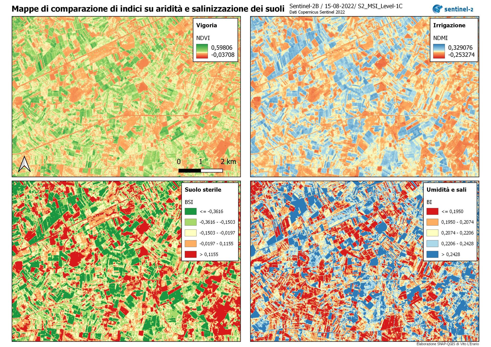
2023: calculation and evaluation of the seasonal average soil moisture index with Sentinel-2 data from the Copernicus and Corine Land Cover 2018 program for agricultural and forestry areas.
Skills
Remote sensing: analysis of images acquired from satellite and airborne platforms (UAS*)
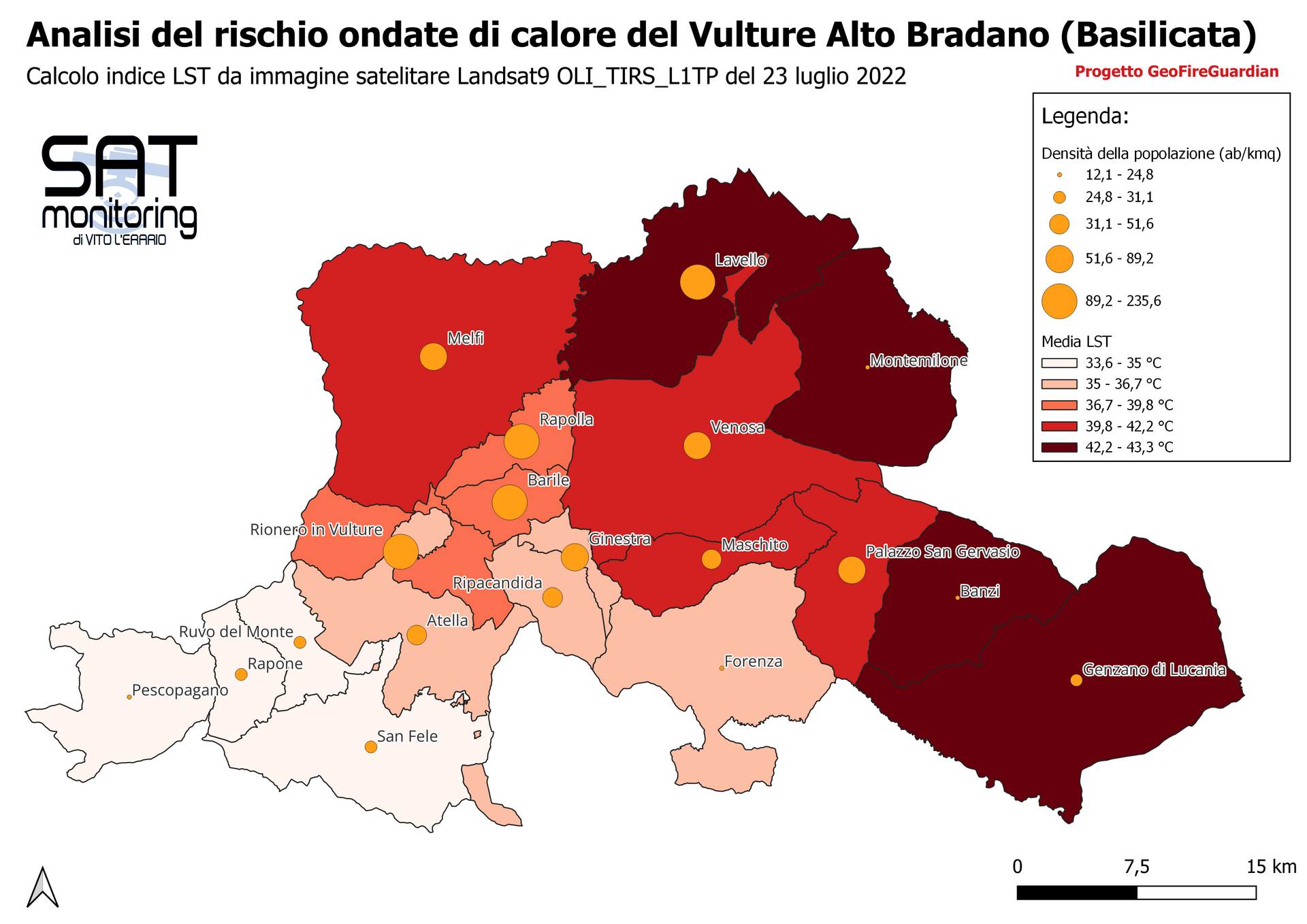
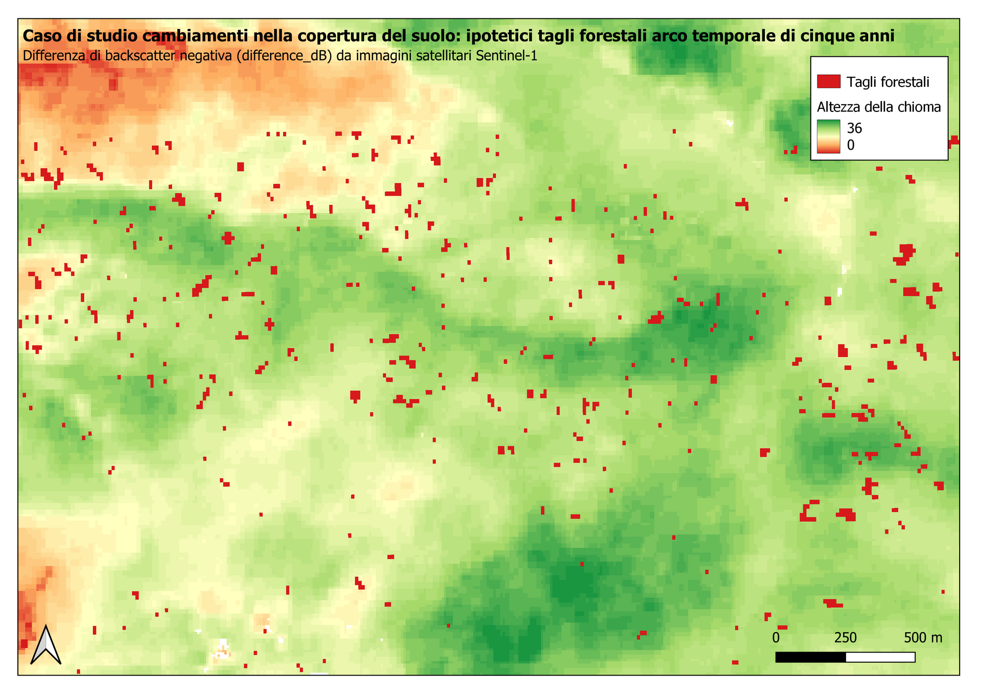
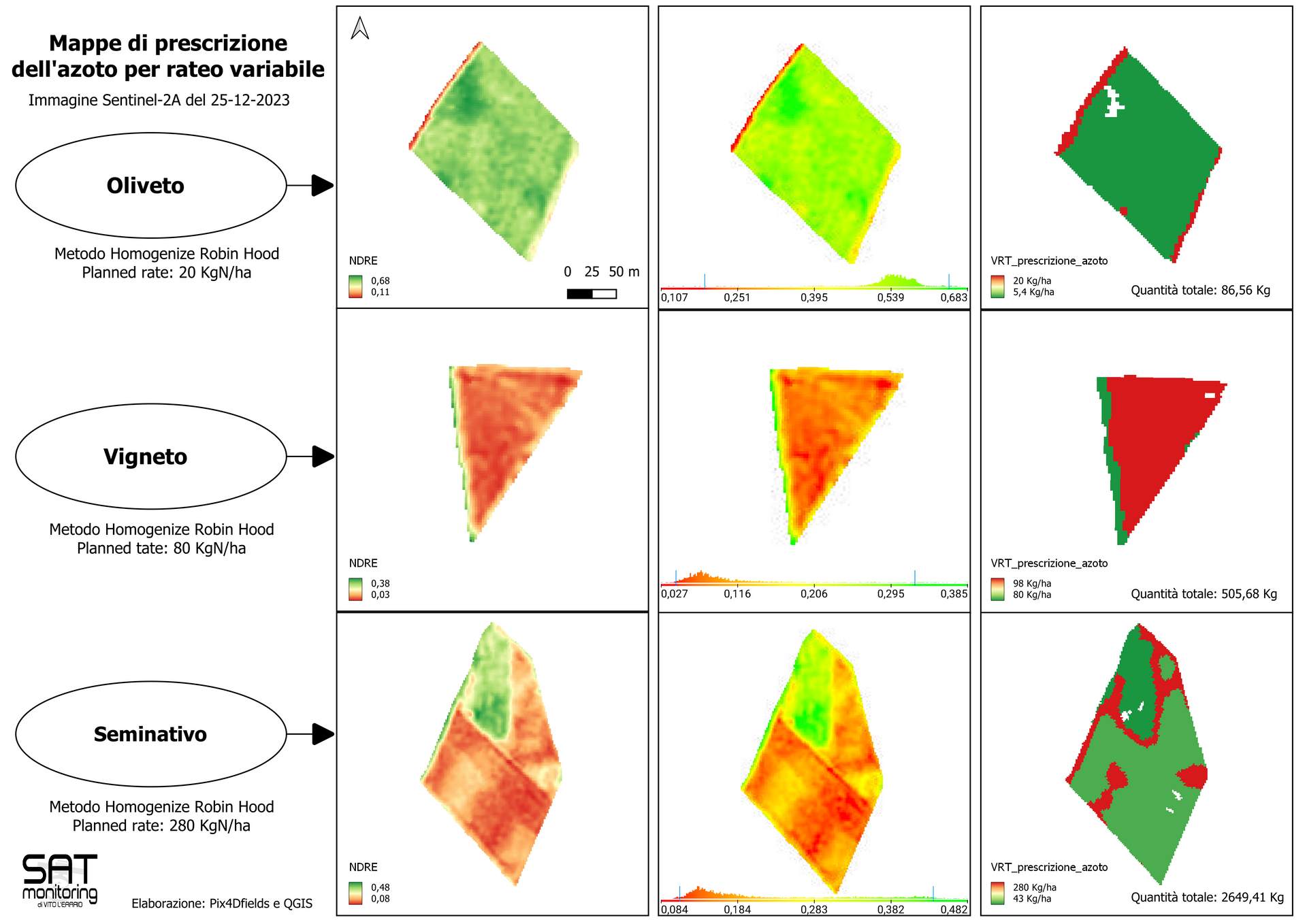
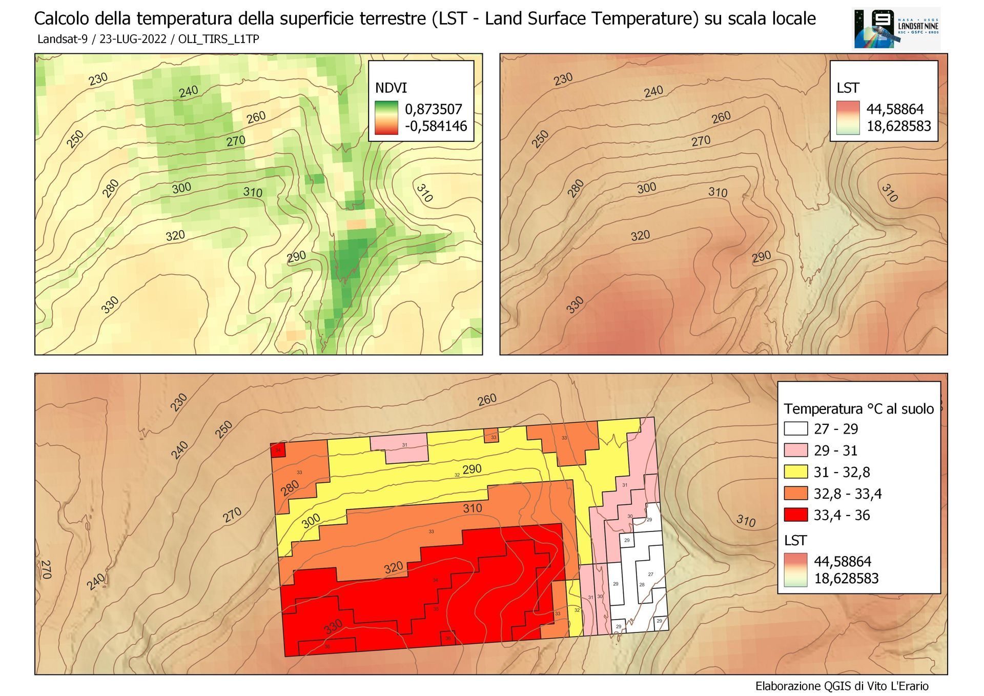
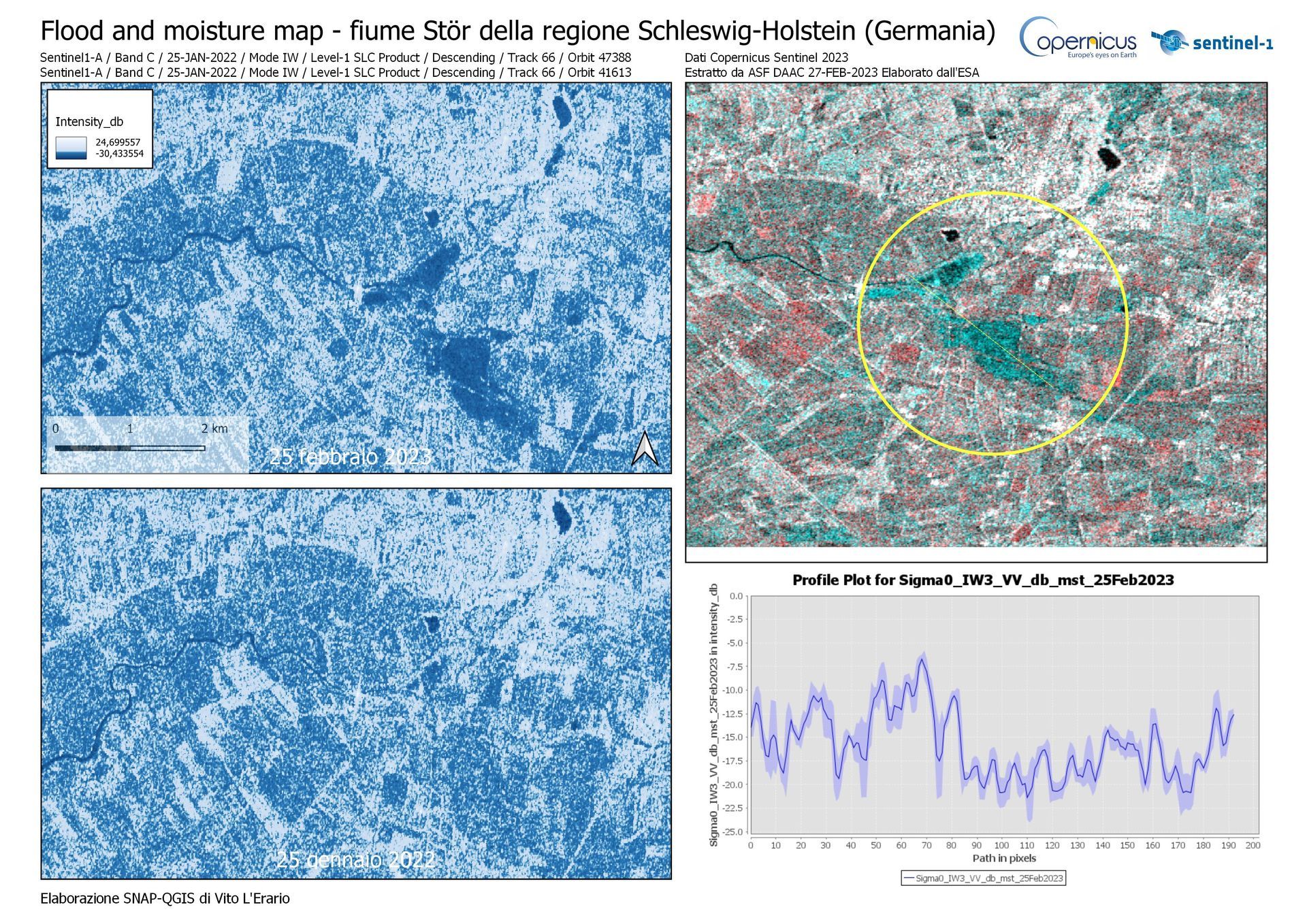
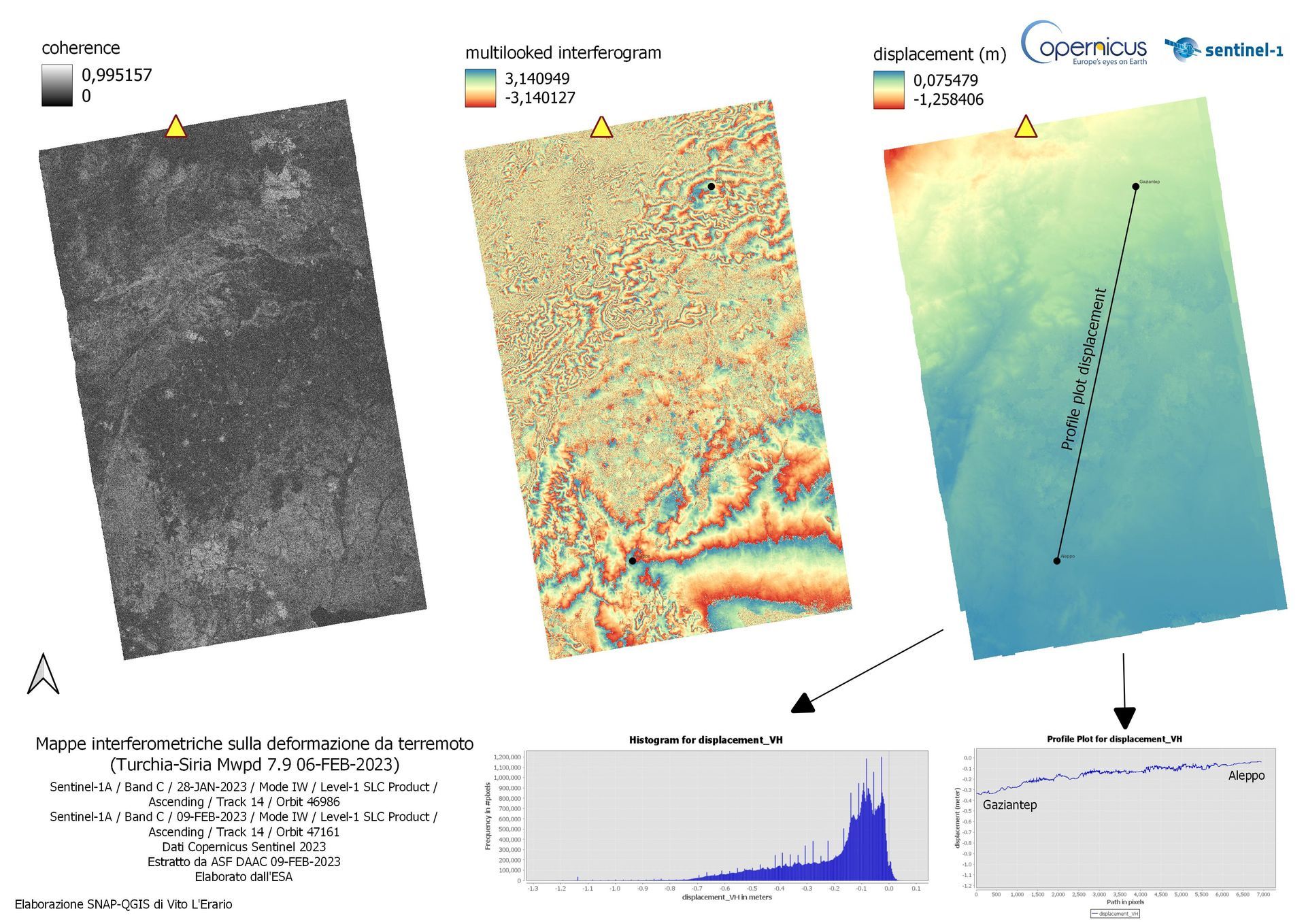
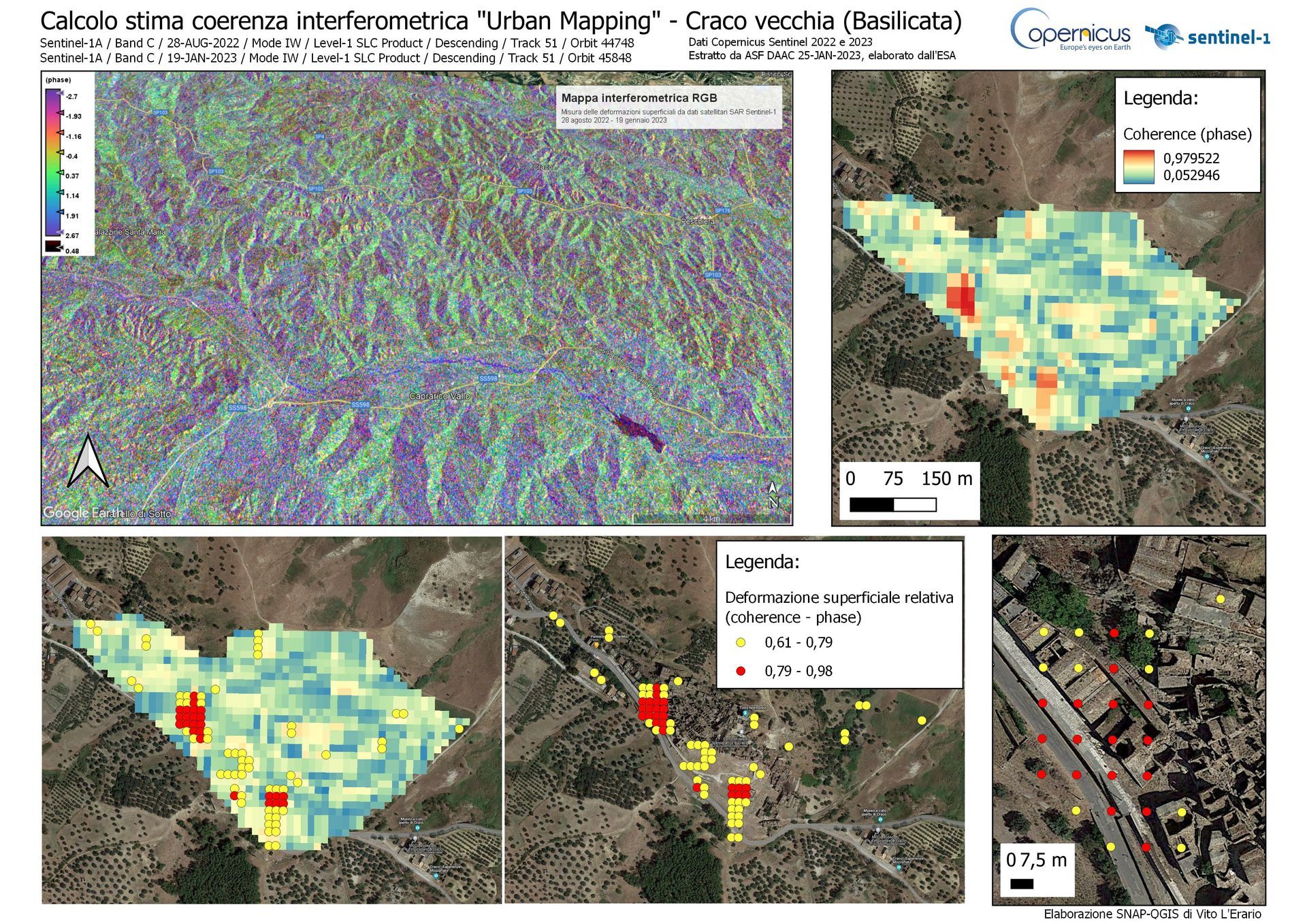
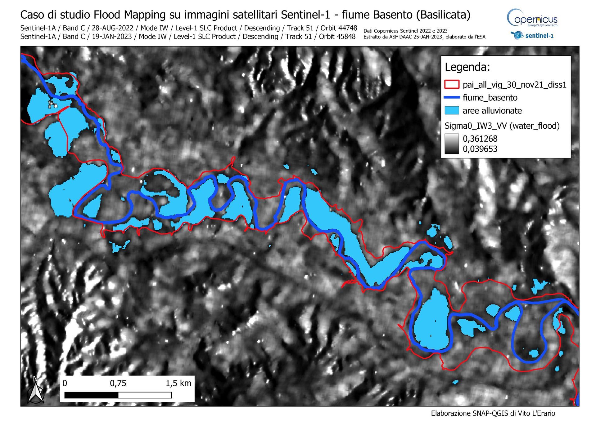
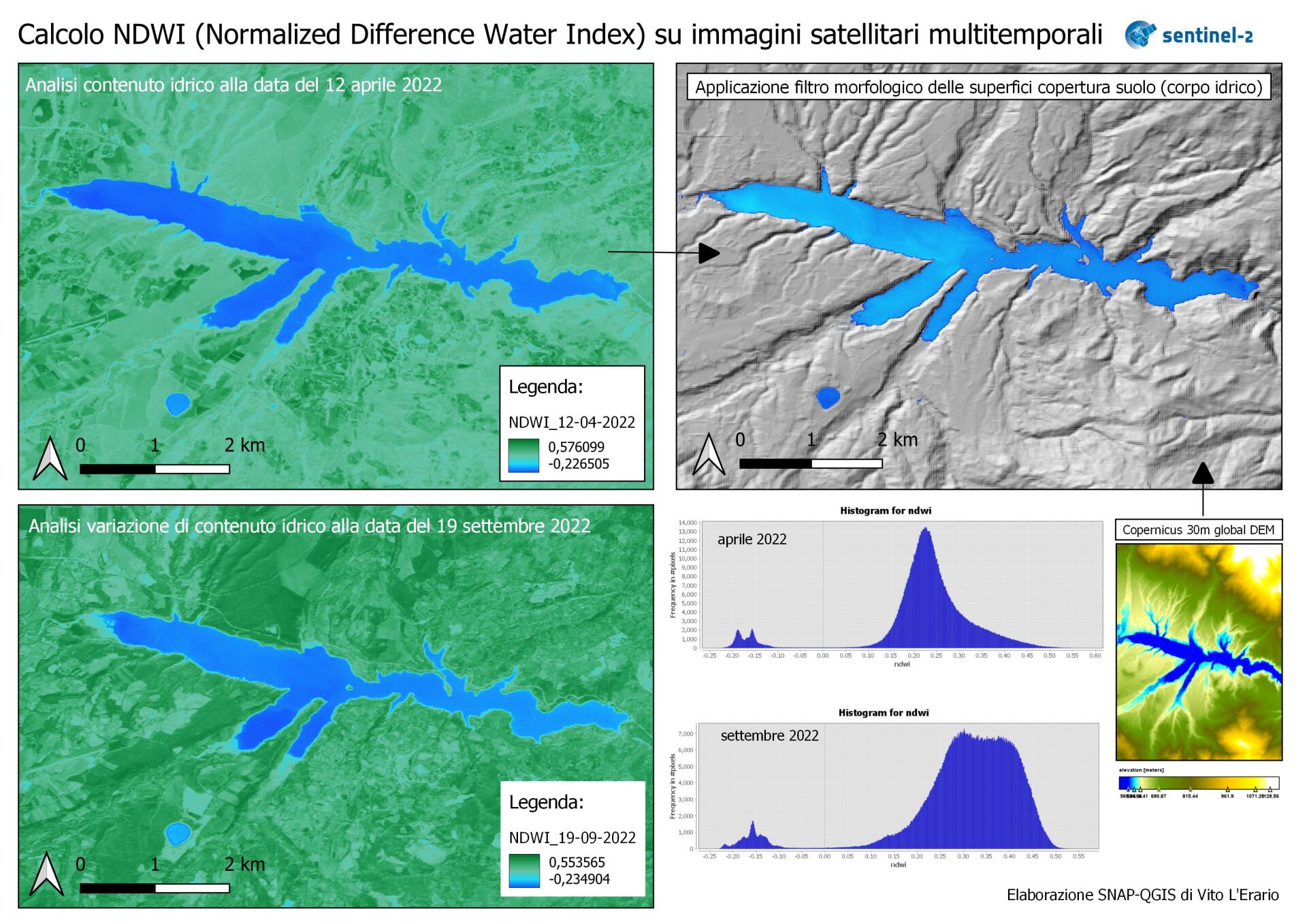
- Passive remote sensing: basic operations for territorial monitoring and operational applications based on Big Data Copernicus Sentinel-2 mission and Earth Explorer USGS Landsat8-9 constellations; calculation of spectral indices (humidity, fires, vegetation, water bodies, earth surface temperature) with SNAP (ESA) and QGIS toolbox; multi-temporal analysis of the territory, automatic classification techniques for unsupervised and supervised images (machine learning); techniques and analysis of digital terrain models; Active remote sensing with SAR data (Synthetic Aperture Radar) Sentinel-1 constellation of the Copernicus program: exploration of radar data with VV and VH polarization; radar metadata analysis with SNAP toolbox; creation of images of breadth and intensity; urban area detection, urban footprint and back scatter differences, offset tracking (surface velocity fields of glaciers); interferometry (calculation of soil deformation, earthquakes, volcanic eruptions, flood events, subsidence, urban mapping). Precision agriculture: tools and techniques for economic and environmental improvement in the agricultural sector; monitoring and data acquisition from ground, satellite and airborne sensors (drones); creation of fertilizer and nitrogen prescription maps.
GIS Open Source
- QGIS: geographical analysis, database, raster and vector geoprocessing, digital terrain models, hydrological analysis with DEM; automatic classification of unsupervised and supervised images (machine learning). WebGIS: web mapping applications, webgis creation with QGIS server and Lizmap, configuration and provision of WMS and WFS services.
* A1/A3 A2 open sub category UAS (drone) pilot, in the flight training planning phase and obtaining the relevant academic certification.
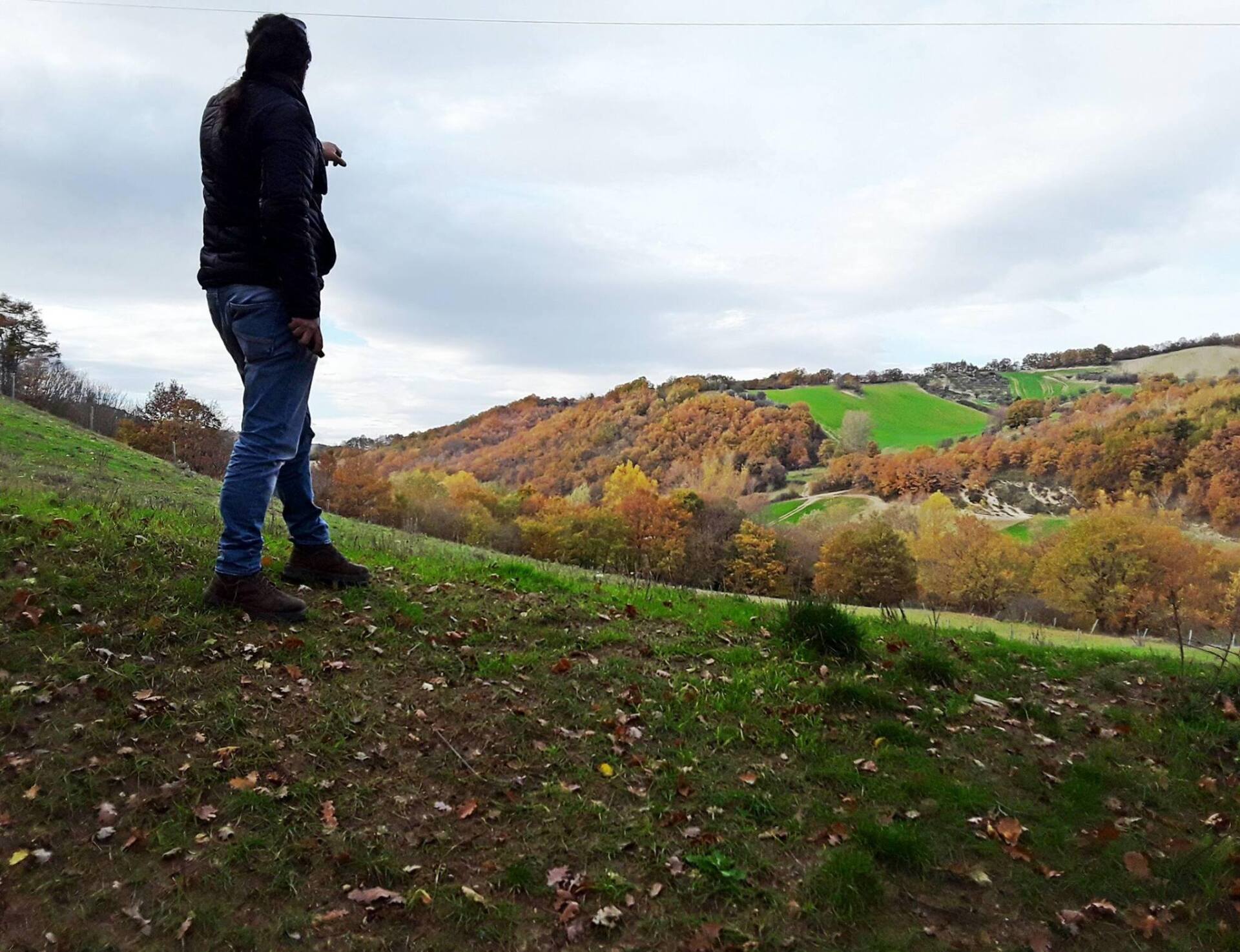
The projects
The processing of data obtained from satellite and airborne images (drones) can contribute to the mitigation of expected event scenarios, also thanks to the analysis and multi-temporal study of the territory. In an era in which the phenomena produced by the climate crisis and the increasingly expected extreme events are affecting the social and economic life of the entire planet Earth, concrete actions need to be implemented.
Monitoring of the Earth Environment System (SATmonitoring) is part of the Earth Observation panorama and intends to actively contribute to the search for immediate solutions.
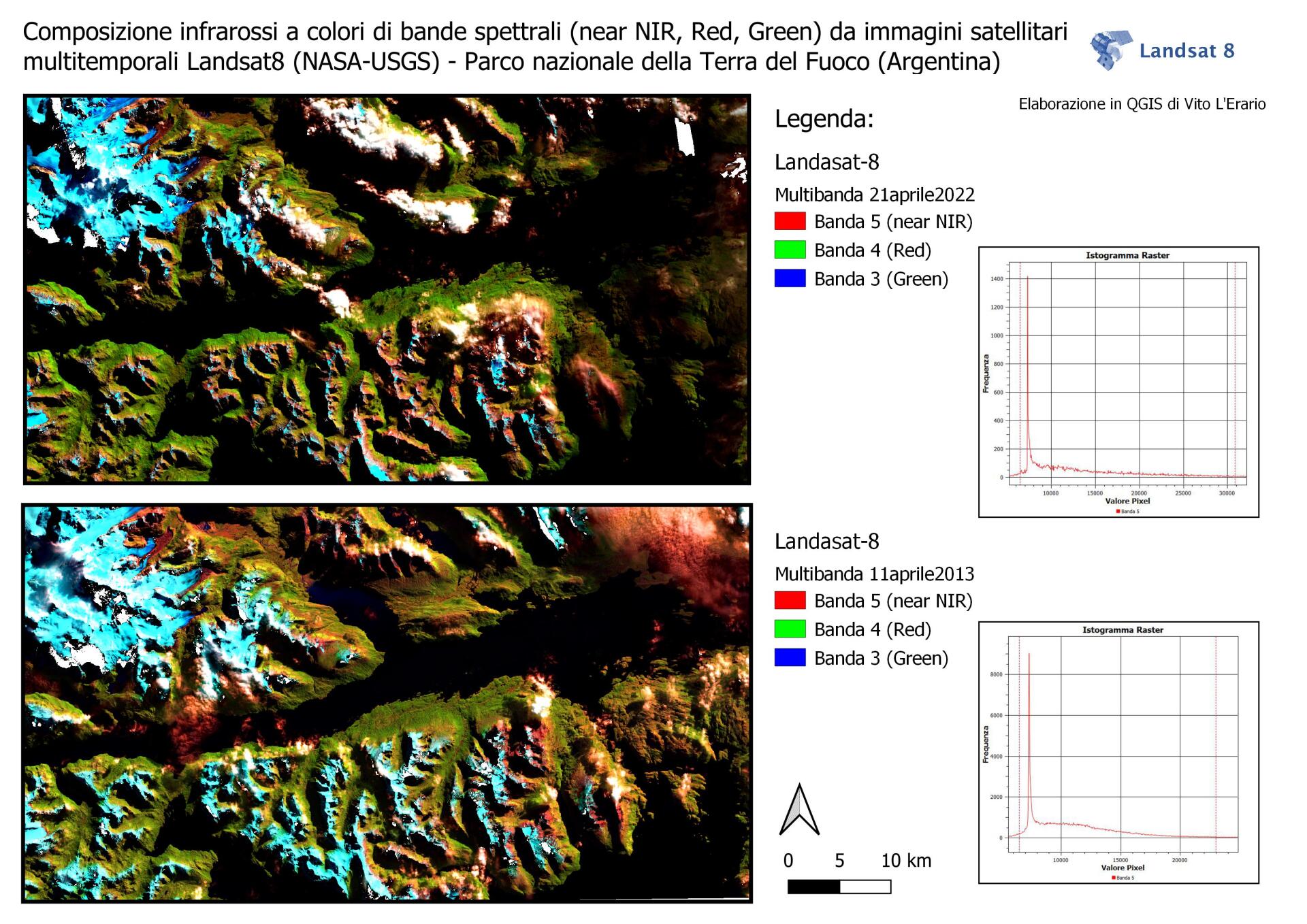
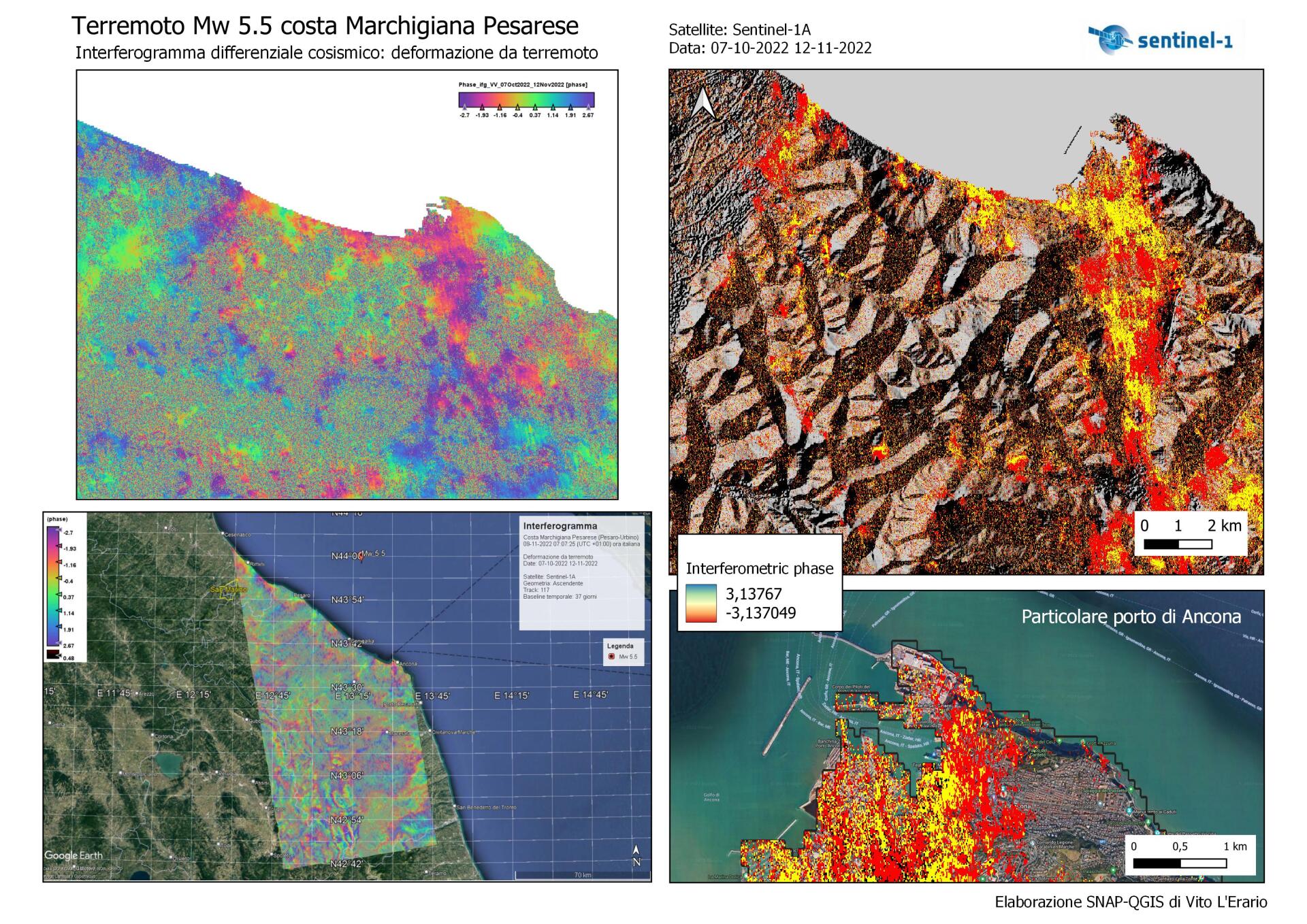
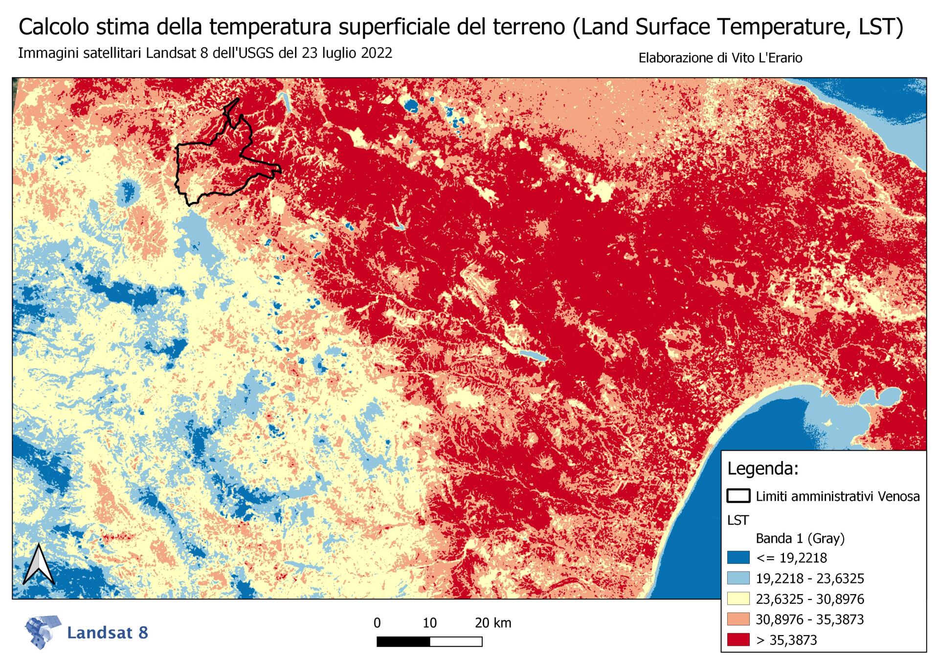
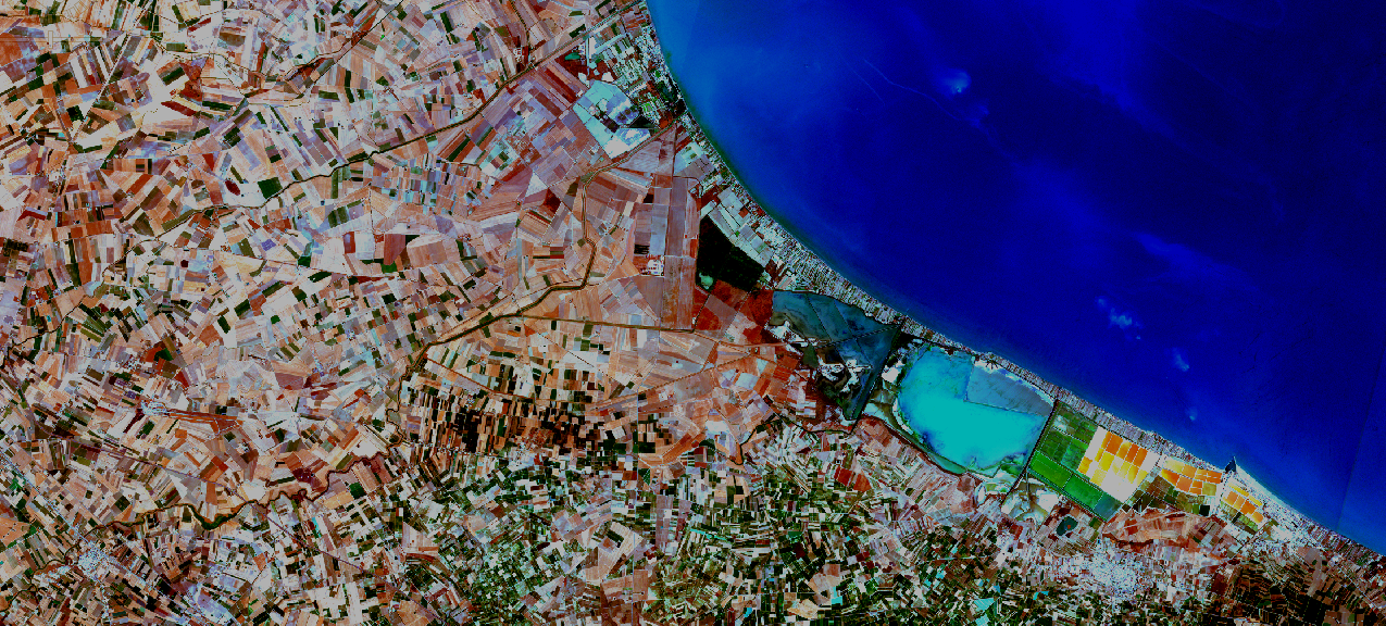
Here are some examples:


| SATmonitoring by Vito L'Erario |
P.Iva 02152550766
CF LRRVTI73R13L738C
Sole proprietorship registered in the Basilicata Chamber of Commerce Register of Companies No. REA PZ-213326
Concessionary measure: Microcredit A, contribution granted €23,390.00
The operation was carried out with the support of the European Union through the European Social Fund (ESF) as part of the OP ESF Basilicata 2014-2020
Received subsidy of €23,390.00, company in flat-rate accounting regime